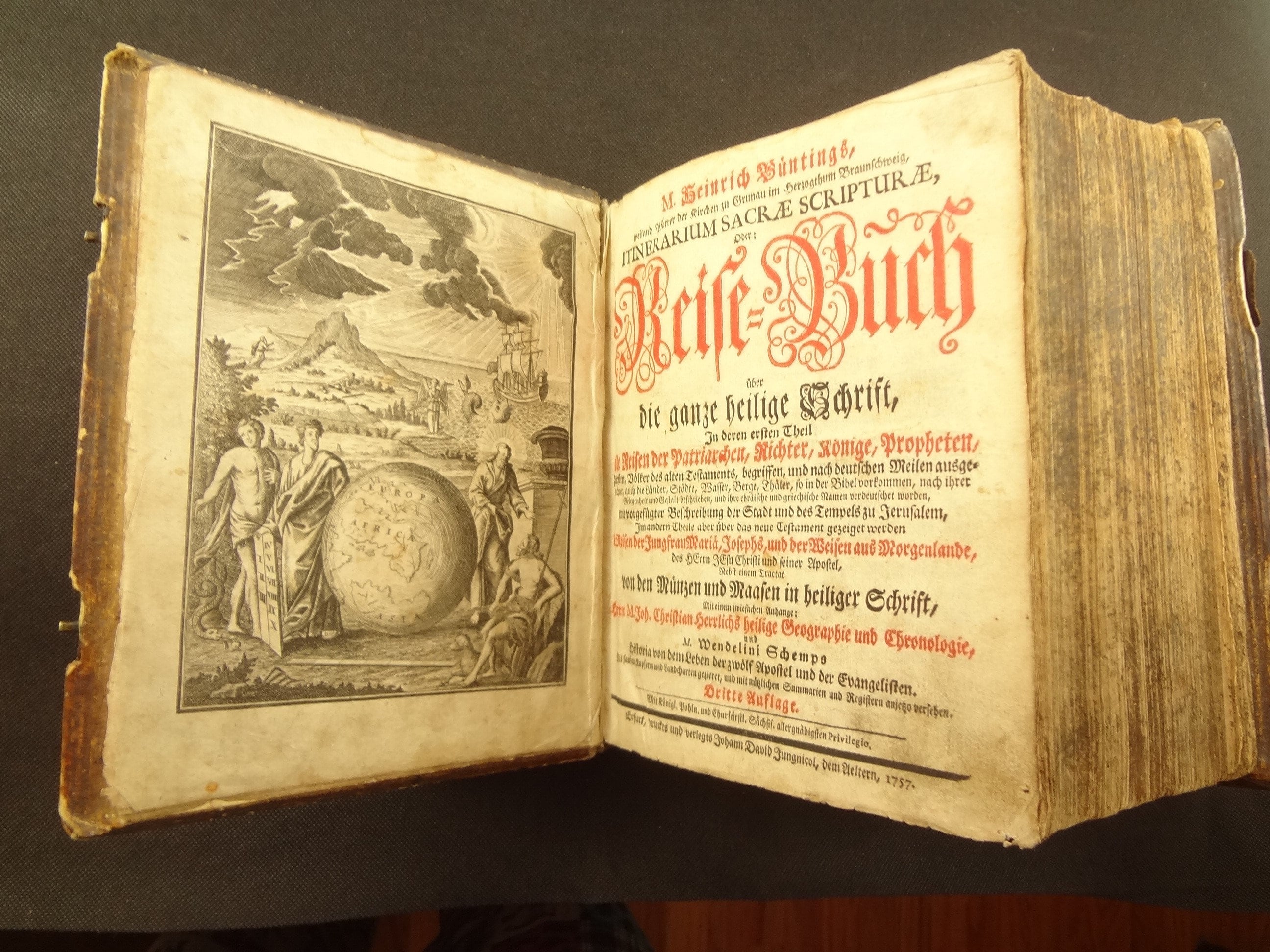
1757 Itinerarium Sacrae Scripturae,Heinrich Bunting. Maps of Israel, 24 plates - Jerusalem, etc.
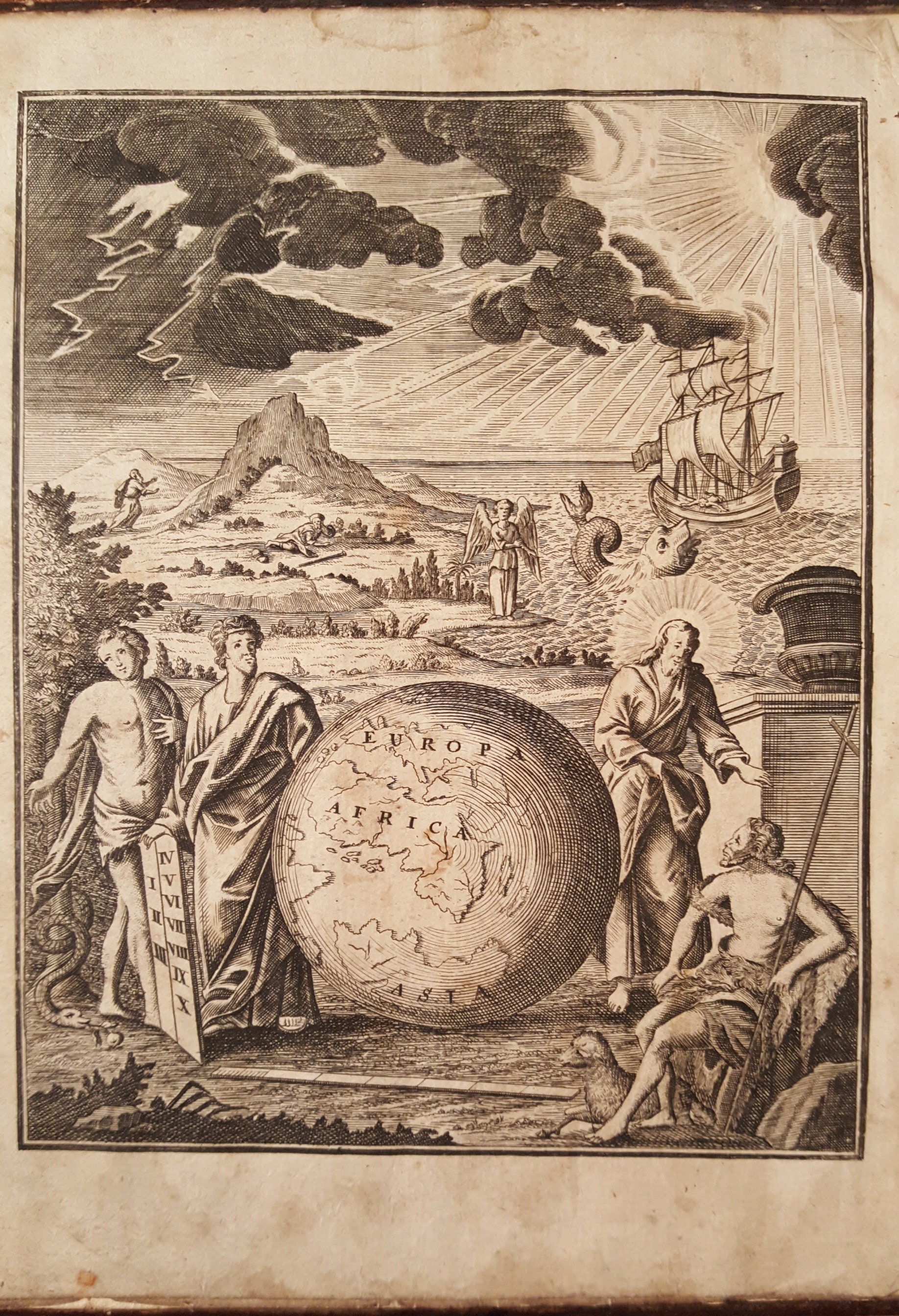
A 1757 edition of Heinrich Bunting's work documenting travels in the Holy Scriptures. This edition has two folding maps, 23 plates, and one frontis plate; the frontis is particularly notable due to the map of the globe, with the America's portion shown in darkness (see pictures).
The two maps are:
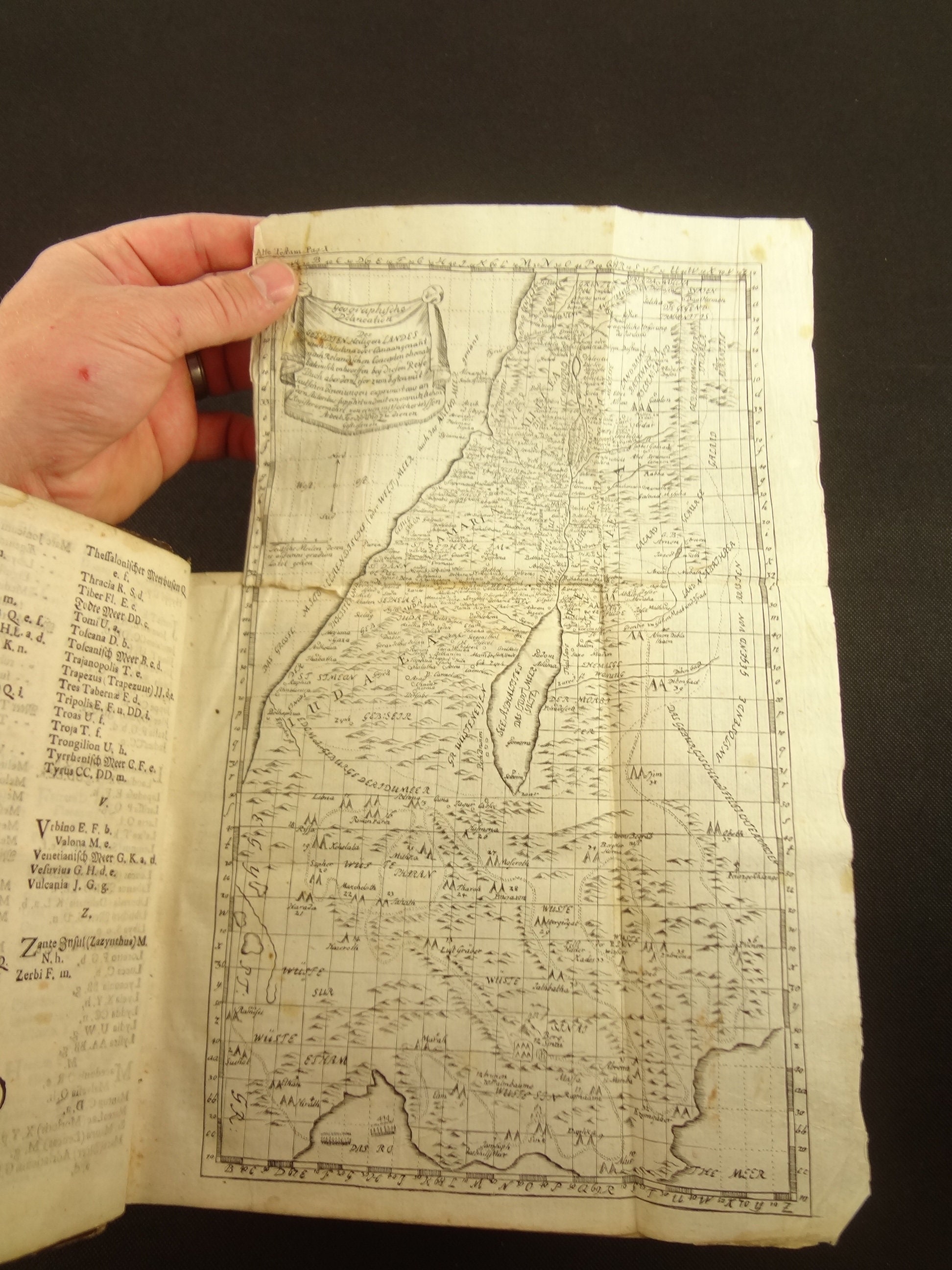
1. Palestine (at the time)/ Israel
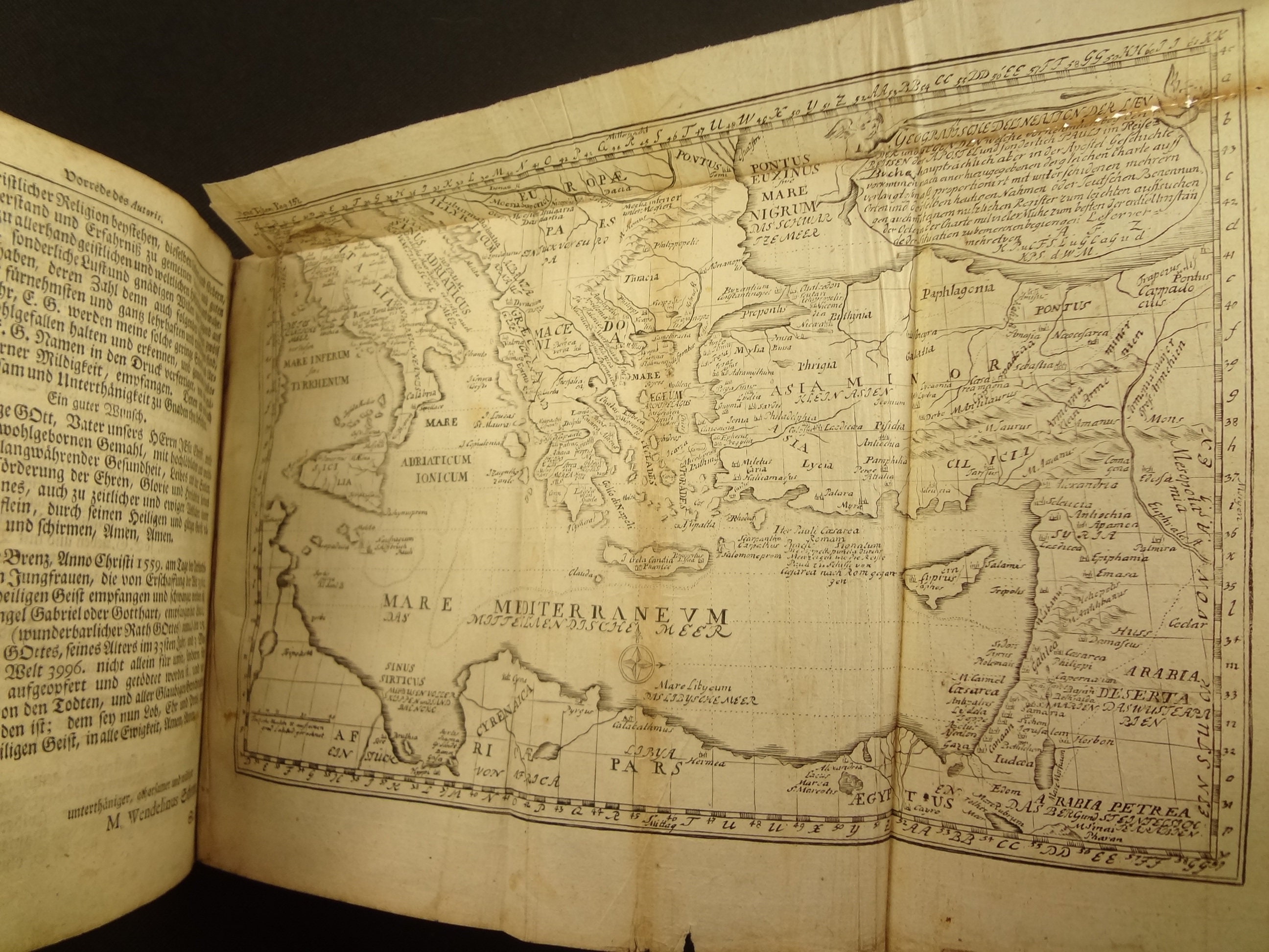
2. The Mediterranean
The OCLC listings for this 1757 edition show some with fewer maps/plates, but it appears the best copies have two maps and 24 illustrations (counting the frontis) so I believe this copy is complete.
This is a thick tome, with several different works, with different title pages and pagination. Works include:
Reise Buch (496 pages)
Itinerarium Novi Testamenti (298 pages)
De Monetis et Mensuris (112 pages)
Heilige Geographie (102 pages)
Historia der Heiligen Zwolf Apostel unsers Herrn Jesu Christi (378 pages)
Different copies of this work seem to have different works bound in; this is one of the thicker volumes I found when compared to what's held in the world's libraries according to the OCLC. One of the better (and closest matching) entries in OCLC is #311926850
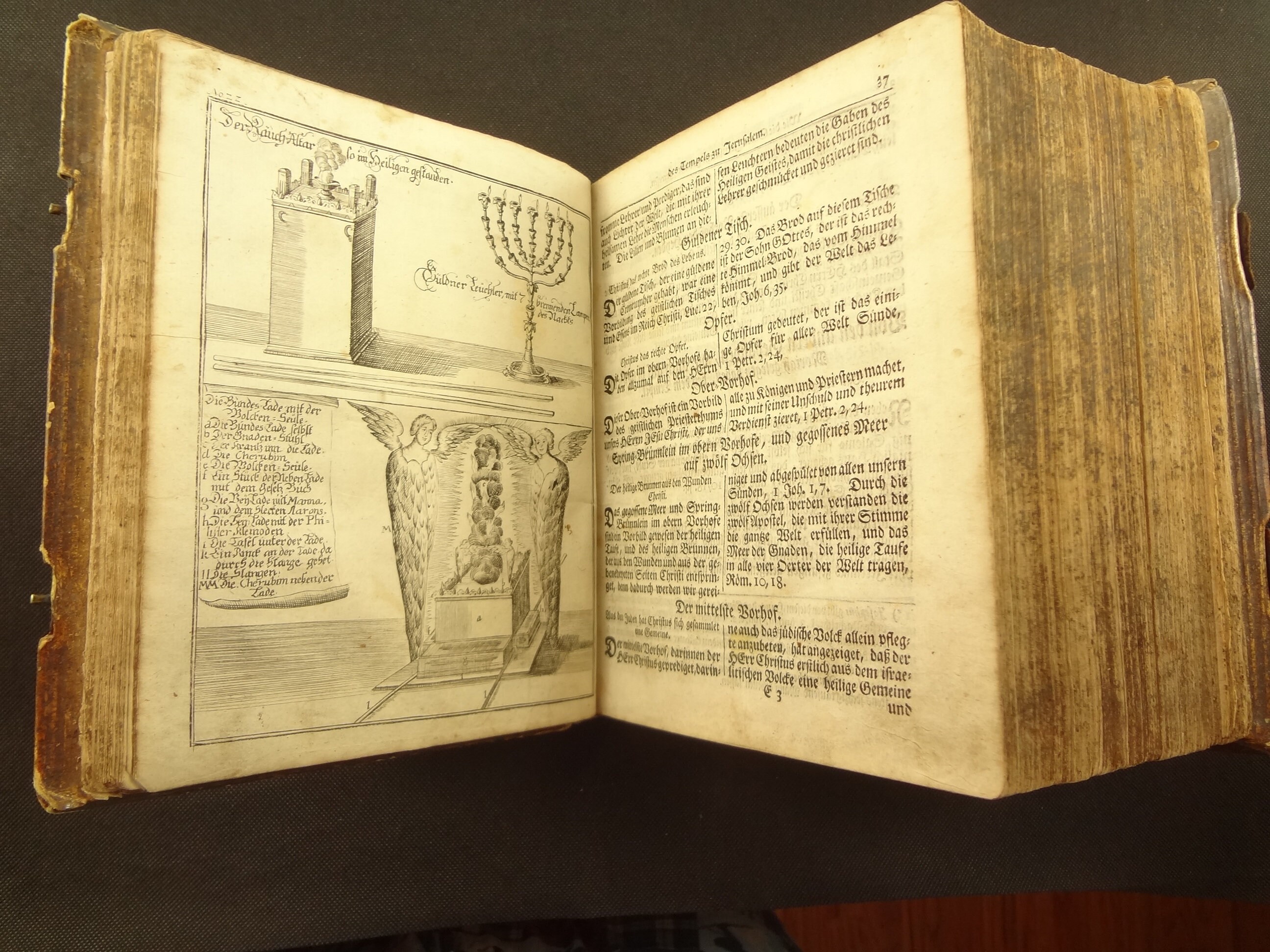
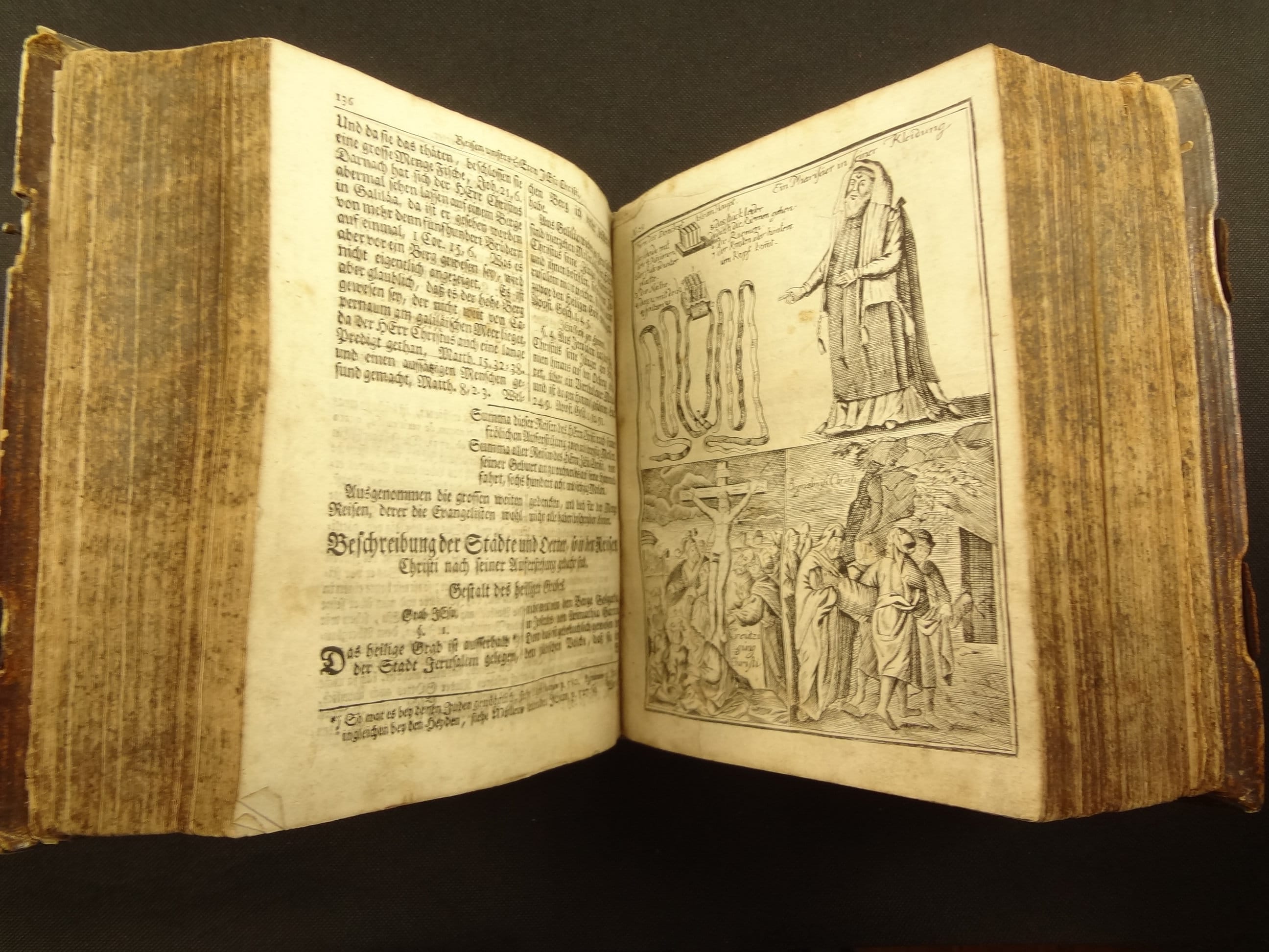
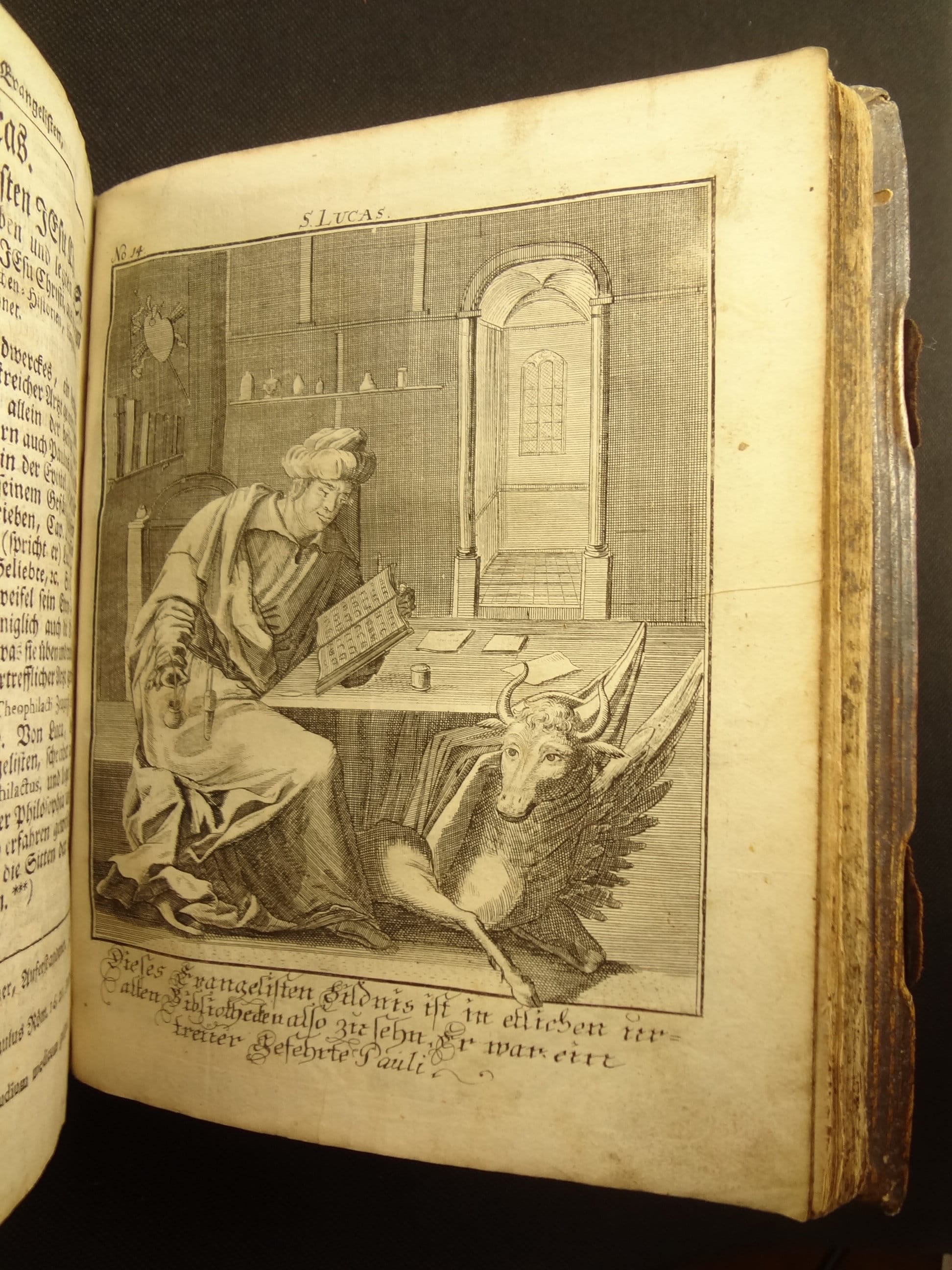
The plates include illustrations of Jewish ritual pieces, places in Jerusalem and the Holy Land, one of money, and portraits of the Apostles.
About the Work -
"Bunting’s collection of woodcut maps, Itinerarium Sacrae Scripturae, first published in Magdeburg in 1581, was a very popular book in its day. It was reprinted and translated many times. The book provided the most complete summary of biblical geography available and described the Holy Land by following the travels of various notable people from the Old and New Testaments." - Wikipedia
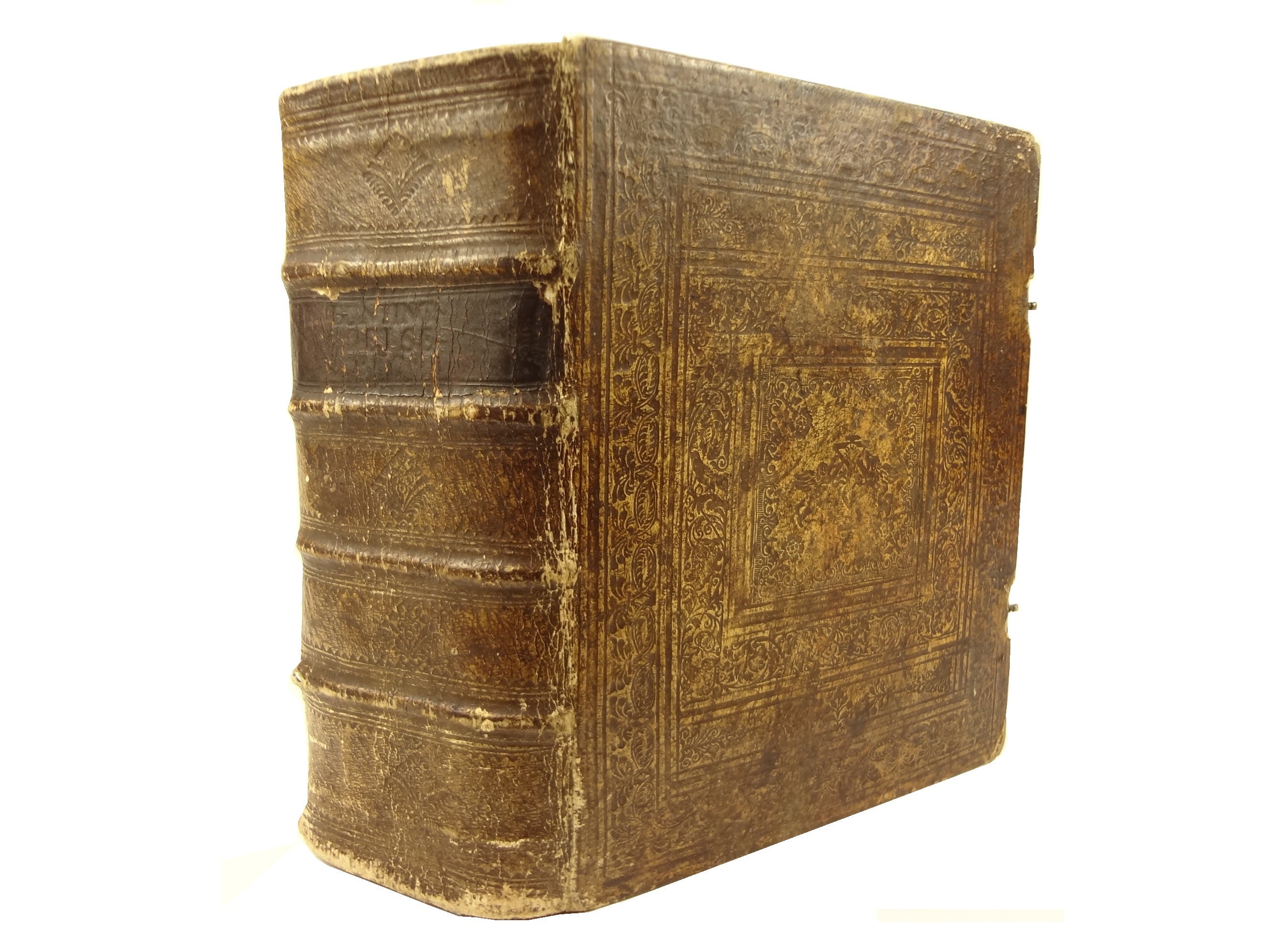
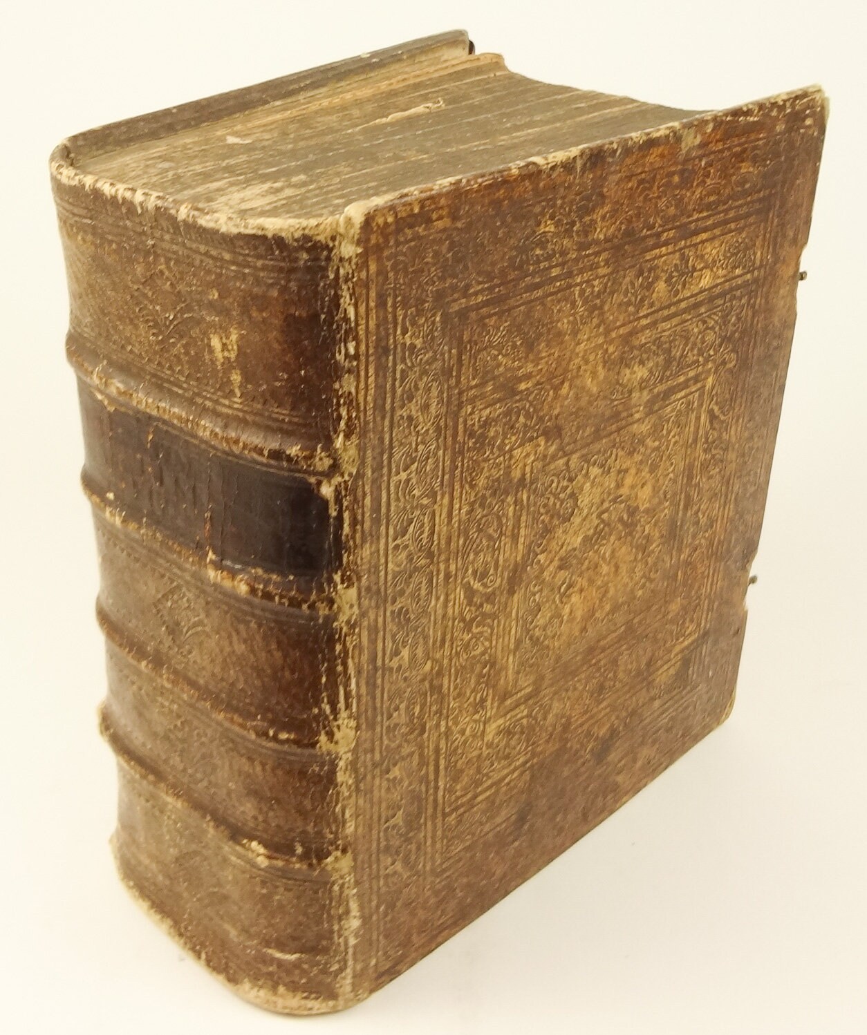
Physical Attributes -
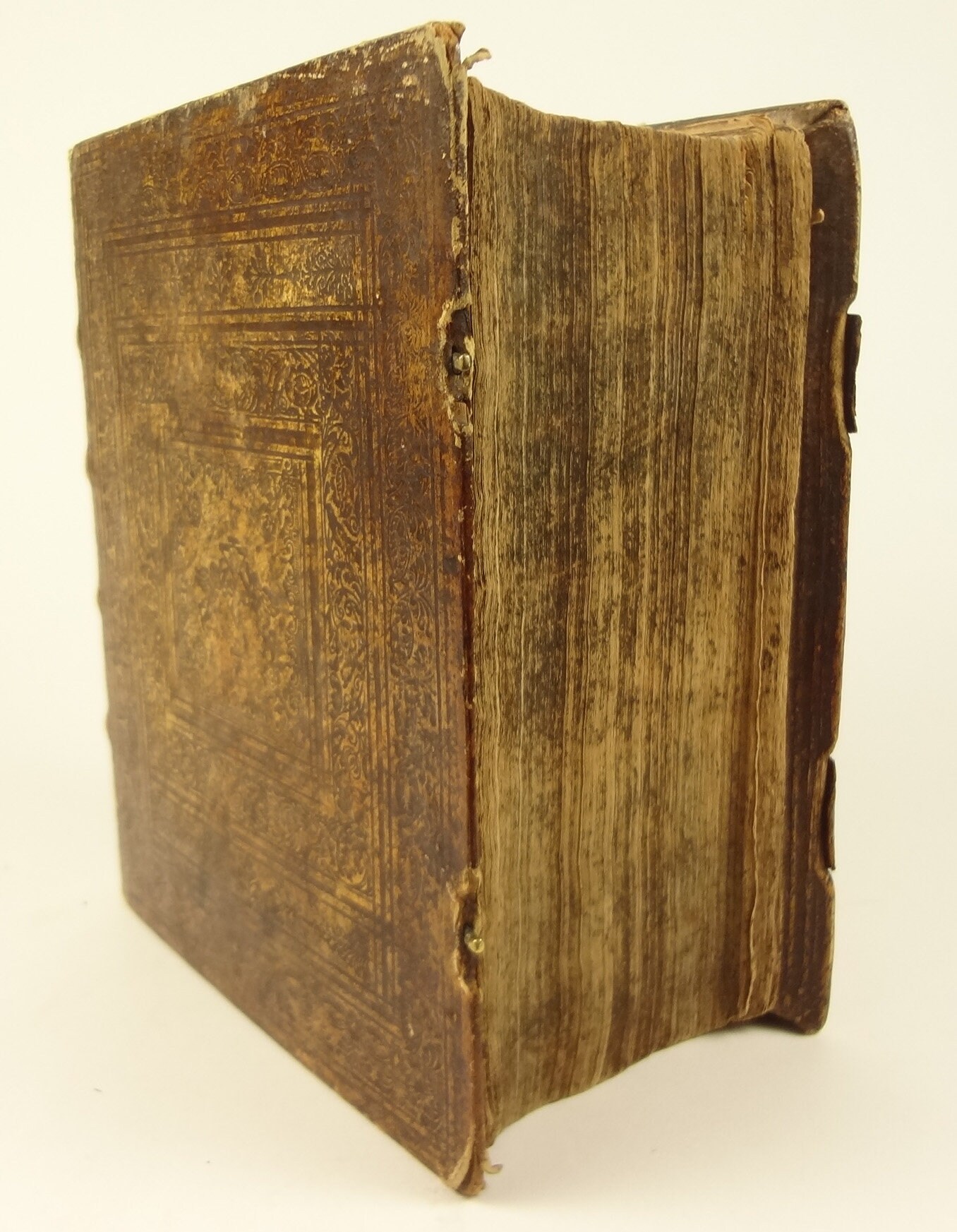
Measures 22.5 x 18.5 x 11 cm. Blind tooled parchment over beveled boards. Four cords to spine, title (faded) on Moroccan in one compartment. Pages - (1) 24, (8), 496, 298, 112, 102, 378, (6), (1)
Condition -
See pictures. Binding well worn, edge wear, ties expired, soiled, etc.; despite wear it has the pleasing look of antiquity. Frontis to page 50 there is a 1" stain at the top edge (marginal, no text touched). Title page is well thumbed; there is a 2" crack at the gutter of the frontis/title page. Book is well thumbed from use at the first quarter of book. The 1st map has a 2" tear at fold. There is a 2"x1" tear/square missing in page 241. The top edge again has a spot from pages 220-320. There is a 4 cm spot on page 291. Occasional dog eared page. Occasional toning to pages. Occasional spot. Section Historia, page 225, 3" tear. Quire at 281-296 sticks out a little (shaken? but seems not loose). Nail rust through rear pastedown and flyleaf from straps. 2nd map sticks out top a little. Occasional stray graphite mark. Despite patina, a pleasing, large tome, which, in a cradle, is enjoyable to peruse.
Shipping from United States
Processing time
1-3 business days
Customs and import taxes
Buyers are responsible for any customs and import taxes that may apply. I'm not responsible for delays due to customs.
Payment Options
Returns & Exchanges
I gladly accept returns
Just contact me within: 7 days of delivery
Ship items back to me within: 14 days of delivery
I don't accept exchanges or cancellations
But please contact me if you have any problems with your order.
Conditions of return
Buyers are responsible for return shipping costs. If the item is not returned in its original condition, the buyer is responsible for any loss in value.
Privacy policy
We do not collect any private information. For billing, Etsy provides the service. We only receive notice that payment was made. The shipping address is provided to us by Etsy, based on what they buyer submitted during check-out. We do not store these addresses. That is the extent of the information that we receive during a transaction.